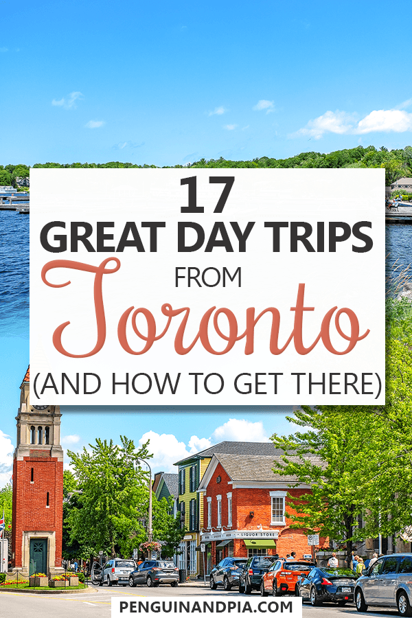
Check Out These Day Trips From Toronto – Told By Our Local!
Let’s be serious, there are some great day trips around Ontario – southwestern Ontario, specifically. The area around Toronto is packed with day trip ideas that have something to offer in all seasons (except beaches, obviously).
Eric would know – he grew up north of Toronto and spent time driving around Ontario for work once upon a time. We then got the chance to explore big parts of Ontario together last summer. So, we know a thing or two about the best and classic day trip ideas – and even a few unusual ones!
Whether you are looking for day trips from Toronto by car, bus, train, or on a tour, we’ve got you covered. From Niagara on the Lake and Niagara Falls to waterfalls and beaches, here is our list of great day trips from Toronto in both summer or winter!
Oh, and if you’re exploring more of Toronto, we’ve got a ton of knowledge for you:
- 27 Things to Do and See in Toronto
- Where to Stay in Toronto: A Neighbourhood + Hotel Guide
- A Perfect Day in Toronto Itinerary
It should be mentioned that Ontario is best to navigate with a car. Public transit infrastructure isn’t that great outside the city centres. So, if you need a car, you can compare prices for different rental companies in Toronto here.
Table of Contents
Niagara Falls
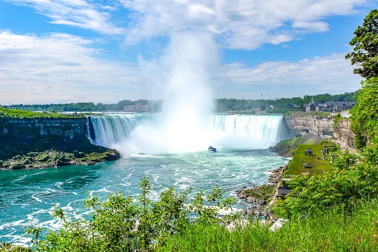
Did you know one of the top natural attractions in the world is a day trip from Toronto? Honestly, you probably did – but it’s good to mention it again anyway! Niagara Falls is a very popular Canadian sightseeing attraction – and for good reason!
Just so we are clear: Niagara Falls, Ontario is a city in Canada while Niagara Falls, New York is the city in the United States just across the river from it – and “Niagara Falls” is also the name of the three waterfalls that people come to see. This includes:
- Horseshoe Falls also known as the “Canadian Falls” is the biggest one people think of first
- American Falls is the name of a smaller waterfall on the American side (also beautiful)
- Bridal Veil Falls is the smallest one right beside the American Falls!
In any case, a visit to the Niagara Falls region is a great idea. There are lots of great attractions that have to do with the Falls themselves like: the famous Hornblower Boat Cruise, Journey Behind the Falls, Skylon Observation Tower, and much more. There are even fireworks each evening in the summer, and the Falls are lit up every night all year round for you to enjoy.
The downtown core of the city – located around Clifton Hill – is loaded with restaurants, casinos, museums, games, and attractions for the whole family like the Niagara Skywheel, Dinosaur Adventure Golf, and many, many more.
North of the main falls area along the Niagara River, there are other natural attractions like the Niagara Whirlpool Jet Boat Tours, the White Water Walk, the Whirlpool Aero Car, The Botanical Gardens + Butterfly Conservatory, and more.
In short, you’d have plenty to do and see in Niagara Falls to fill up a day trip. Because Niagara Falls is so popular (especially in the summer time), it would be a good idea to book tickets for top activities (like the Hornblower Cruise) ahead of time to make it easier for yourself.
You can start your visit at the Welcome Centre – it’s right at the edge of Horseshoe Falls. We’ve also written extensive guides on things to do and see in Niagara Falls, Canada as well as a guide on where to stay in Niagara Falls (just in case you love it so much you do decide to stay over)!
Address for Table Rock Welcome Centre: 6650 Niagara Pkwy, Niagara Falls, ON, Canada
Toronto to Niagara Falls By Car
Niagara Falls isn’t that far from Toronto – it’s just around the end of Lake Ontario to the southeast. That said, the driving distance is around 130 kilometres and might take as little as 1 hour and 30 minutes.
The most direct/popular route is to hop on the Queen Elizabeth Way (QEW)/403 towards Hamilton but you could also take a more scenic route on Highway 81 through areas like Beamsville.
Once you get closer to the Falls on the QEW, follow signs and exit onto ON-420/ Niagara Veterans Memorial Highway East. You can then find parking near the Falls for a high price (but convenient) or find a cheaper lot (but have to walk a bit).
HOWEVER, if you are driving you absolutely have to account for traffic in and out of Toronto and through Hamilton. During morning and afternoon commuter times you might expect to add on 30 minutes to an extra 2 hours of driving time.
Toronto to Niagara Falls By Train
If you want to take the train, you have two options which can be limited depending on the time of year: the GO Train and the ViaRail. Both trains leave from Toronto Union Station in downtown Toronto.
Address of Union Station: 65 Front St W, Toronto, ON
The GO Train from Toronto to Niagara Falls Station is seasonal – it only runs in the summer and on select big weekends in the Fall. You CAN take the GO Train for Toronto to Burlington and then get on a GO Bus to Niagara Falls (Route #12). This combo route runs all year round. Check out the GO Transit Website for details on this route.
The ViaRail train also leaves from Toronto Union Station but only runs once per day in the morning taking about 2 hours to get to Niagara Falls. There is also one return ViaRail train each day. You can check the ViaRail website for schedules and details.
Both trains arrive at the same station in Niagara Falls located north of the main Falls area. You can hop on the WEGO bus (also seasonal), call a cab, or just walk – it’s a nice walk along the river (about 25 minutes) all the way to the Falls!
Address: 4267 Bridge Street, Niagara Falls, ON
Toronto to Niagara Falls By Bus
For buses direct to Niagara Falls from Toronto, you have two options: the Greyhound Bus or Megabus. Both buses leave from the same station in Toronto.
Address of Toronto Bus Terminal Downtown: 610 Bay Street, Toronto, ON
Megabus has lots of daily departures for trips that take about 2 hours and good fares (approximately 20 CAD one way). You can check here on the Megabus website.
Greyhound has four direct buses a day for about the same travel time and about the same prices. You can check fares on the Greyhound website. Once you arrive in Niagara Falls, both buses get into the same station in Niagara Falls (which is right across from the train station).
Address of Niagara Falls Bus Terminal: 4555 Erie Ave, Niagara Falls, ON
Toronto to Niagara Falls Tour
Another way to get to Niagara Falls that is easy and takes the stress out of the logistics and traffic is by hopping on a shuttle or tour. Tours are also a good cost-effective way to see the Falls without having added expenses like daily parking. Luckily for you, Niagara Falls is very popular so there are many that you can choose from!
Before you book a tour, definitely look into the itinerary – some tours are just for Niagara Falls while others give you free time/wine tastings in Niagara on the Lake (mentioned below).
In any case, tours are a good way to sit back and relax while a guide takes you to the best experiences and sights!
- For a tour right from Downtown Toronto with guided free time at Niagara Falls and a wine tasting, check out this Niagara Day tour from Toronto.
- For a taste of Niagara Falls (with an option to add the Hornblower Cruise), check out this very popular day tour from Toronto to Niagara Falls.
Niagara-on-the-Lake
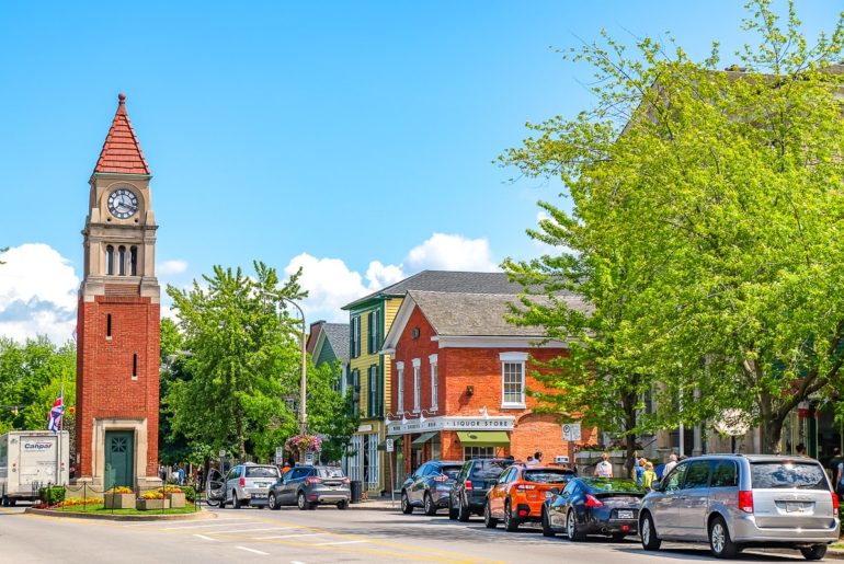
If you want to explore Ontario’s premier wine region, you have to check out Niagara on the Lake. Yes, you COULD visit Niagara-on-the-Lake (NOTL) when you visit Niagara Falls – but you could just as easily make either of them their own day trip since there is enough to explore.
Niagara-on-the-Lake is actually both a region and also a lovely little town in the region. Think of it as the capital of the area. This historic town is full of charm – shops, restaurants, historic sites, waterfront parks, and more.
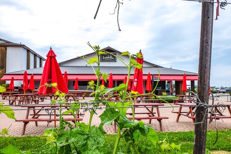
That said, the region is well-known in Canada for the wine. NOTL is a fertile area with a unique climate that is shaped by the Niagara Escarpment. As such, there are well over 90 wineries in the Niagara Region – many of which are in Niagara on the Lake.
Niagara-on-the-Lake is also one of the few places in the world that can produce Ice Wine – a sweet wine that is harvested from frozen grapes! In any case, we would definitely recommend a day in NOTL – the region has loads to check out on its own and it’s beautiful.
We did a wine tour of the region from Niagara Falls but you can sign up for a tour once you get to town. You can also do a self-guided tour which is easy when you have a winery map! We actually wrote an article about some of our favourite wineries in Niagara on the Lake if you are interested in scouting out a few before you go!
- Things to Do in Niagara on the Lake (coming soon!)
- Niagara-on-the-Lake Wine Tours – Our Awesome Day Tasting!
- Just In Case – Our Niagara on the Lake Accommodation Guide
Downtown NOTL: 6 Picton St, Niagara-on-the-Lake, ON L0S 1J0, Canada
Toronto to Niagara-on-the-Lake By Car
The BEST (and basically only) way to get to Niagara-on-the-Lake (the town) -and to get around the whole region once there – is with a car.
Niagara-on-the-Lake is located about 20/25 minutes north of Niagara Falls so you basically drive there the same way – on the QEW/403 highway towards Hamilton. Once you get close, you can get off in St. Catharines or in Glendale and follow signs into the region (usually via highway 55 which runs through the whole region) directly to the town of Niagara-on-the-Lake.
The drive will take about 1 hour 30 minutes total. You’ll find paid parking downtown NOTL – and free (sneaky) parking near the Fort if you don’t mind a bit of a walk!
Toronto to Niagara-on-the-Lake By Train
There is no direct train from Toronto to Niagara-on-the-Lake (the town). You can get to “Niagara College” which is a campus IN Niagara-on-the-Lake if you train to St. Catharines but NOT close to the main old town.
Toronto to Niagara-on-the-Lake By Bus
You also can’t get to the town of Niagara-on-the-Lake by bus right from Toronto. You’d have to take a Megabus to St. Catharines and then take regional buses into the region (not super easy for the purposes of a day trip).
The other option is to get to the Niagara Falls bus station (mentioned above in Niagara Falls) and then take the WEGO NOTL route (only in the summer) or take a taxi (about 25 minutes) from the bus station to NOTL.
Toronto to Niagara-on-the-Lake Tour
Since a car is basically the only way to get there for the purposes of a single day trip, you could also look into a tour to get there and back without hassle. A tour is also nice because then you have a designated driver!
- For a great dedicated Niagara on the Lake wineries tour (plus chocolate factory), check out this Niagara-on-the-Lake Day tour from Toronto.
- Another great combination tour that includes a winery stop but also emphasizes seeing Niagara Falls is this Day tour to Niagara from Toronto.
Toronto Islands
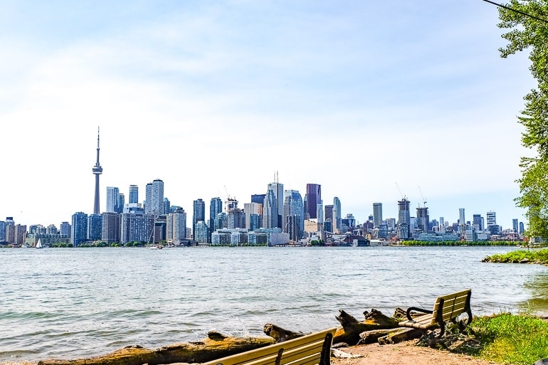
If you want to get out of the city for a day – but don’t want to go too far at all, you can head across the lake to Toronto Islands! “The Island” is actually made up of 15 large and small islands that are connected by bridges or walkways. In fact, it’s the largest car-free neighbourhood of any city in North America!
The Islands are a popular escape in most seasons – you can even visit in the winter – since there are many attractions (like Centreville Amusement Park), beaches (there’s even one clothing-optional), smaller parks and green spaces for picnics, biking paths, the opportunity for boat rentals, and more! There are also a handful of cafes, bars, and restaurants around the island.
We visited the Islands this past summer and loved it. We took the ferry from downtown (more on that right below). Once there, we went to the beach, walked almost the whole length, got a bite to eat, and came home after a long day just enjoying the slower pace compared to being in the big city!
Believe it or not – people actually do live on the island. Since there are no cars, a bike is a very popular way to get around. You’ll find bike rentals everywhere. If you want to make the most of your time on the island, you should check out a bike tour with a local!
Toronto to Toronto Islands By Car
It’s an island. You can’t drive there, silly.
Toronto to Toronto Islands By Ferry/Water Taxi
To get to the Island, you have to go by boat but you have two options: The official ferry or a private water taxi. We bought a ticket for the ferry. There are actually three ferry routes that leave from the same spot (Jack Layton Ferry Terminal) downtown Toronto – but the ferries run to three separate locations on the Island: Centre Island, Hanlan’s Island, and Ward’s Island.
The ferry only takes like 13 minutes to cross but loading and unloading can take a few extra (especially in summer). The nice thing is that when you buy a ticket, it includes the price for a return ticket. So you show a ticket to get on the ferry but to come home from the Island you just get on any ferry you like.
For example, we took the first ferry to Centre Island and came home from Ward’s Island Ferry Dock. No problem. You can buy a ticket online here (which we recommend because the line up to buy in-person was massive in the summer).
The other option to get to the island is to hop on a private water taxi. Because they are smaller to load and faster to cross, they are a bit more expensive than the regular ferry ticket – but generally worth it if you don’t like long lines. There are a few companies if you want to shop around at the pier – or you can check out Toronto Harbour Water Taxi here.
Address Jack Layton Ferry Terminal: 9 Queens Quay W, Toronto, ON M5J 2H3, Canada
Related: Must-Knows for Travelling to Canada for the First Time
Scarborough Bluffs
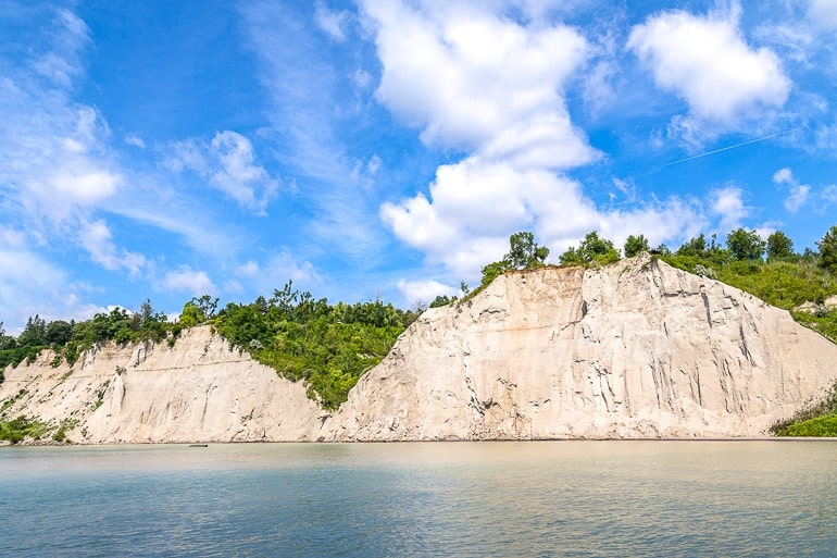
If you are looking for another outdoor adventure where you don’t have to travel too far at all, then head for the Scarborough Bluffs! Located to the east of the city centre out in Scarborough, the Bluffs are a stretch of rocks cliffs/shoreline that carry on for 15 kilometres!
Currently, there are actually nine formal park areas along the shoreline – some with walking trails and picnic areas throughout. The only formal beach is found at Bluffers Park.
Down at the water’s edge, there is a large marina area with a pub/restaurant and more walking trails/bridges over the smaller coves. You’ll find great views of the massive cliff face standing (300 feet) above the Lake!
If you want to get those stunning views, this would be from Scarborough Crescent Park – but please be careful atop the cliffs. You can actually be fined for crossing over the fence to get close to the edge. It’s dangerous due to ongoing erosion.
Address for Bluffers Park: 1 Brimley Road S, Scarborough, ON M1M 3W3, Canada
Toronto to Scarborough By Car
Because the Bluffs are just in the far east end of Toronto, they are relatively easy to get to. If you have a car, this process is very simple. The thing you will have to consider is where you are actually going since there are numerous park/beach areas and a handful of different parking lots to choose (Bluffers Park Parking and Bluffers Beach Parking).
That said, driving to the Bluffs from the west end, north end, or anywhere downtown will take anywhere from 20 to 40 minutes depending on where you are coming from. It’s about 15 kilometres driving distance from downtown – so not far.
You can make your way along Queen Street East to The Beaches (a neighbourhood) and then turn left to basically follow Kingston Road all the way to Brimley Road South.
You could also take Danforth Road east (if you’re starting off farther north) but you’ll need to head south eventually to get to the shoreline. You could also call an Uber since Toronto is pretty Uber friendly.
Toronto to Scarborough By Public Transit
You definitely don’t need to drive to the Bluffs to enjoy them. There are a handful of combinations you can take to reach the Bluffs using public transit.
Without too much detail, you can either take the GO Train to Scarborough GO Station (from Union) or take the TTC (Toronto subway) to Kennedy Station or Victoria Park Station.
From those closest stations, you can get on a bus to take you down/along to Kingston Road. Whichever route you go, you’ll end up basically getting off somewhere along Kingston Road and walking down Scarboro Crescent (a road) or Brimley Road S towards the waterfront.
If you’re in Toronto for a while (or live there), you should use a Presto Card for easy (cheaper) payment. Of course, you could also buy a paper ticket (for the GO Train).
Hamilton Area Waterfalls
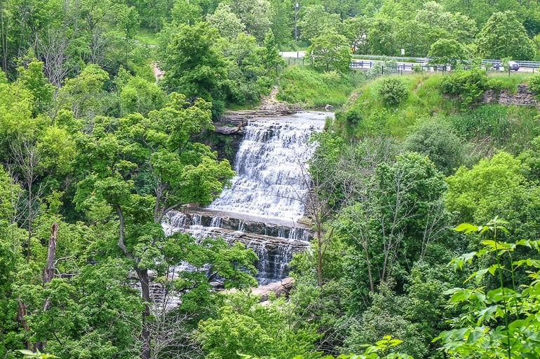
It’s been said that Hamilton, Ontario is the waterfall capital of the world – and we would believe it! The region just west of Toronto on Lake Ontario is home to well over 100 naturally occurring waterfalls. The number of waterfalls is thanks to the Niagara Escarpment that runs through southwestern Ontario (and beyond).
You can visit Hamilton – the city – but we’d suggest checking out the conservation areas, parks, trails, and waterfalls in the region all around the Hamilton area as well. We spent a day physically driving around the area chasing waterfalls and going for hikes in conservation areas – and it was awesome!
To get you started, we explored a few popular ones and a few smaller ones to get a variety. This included Albion Falls, Buttermilk Falls, Devils Punchbowl out in Stoney Creek, and the classic Tiffany Falls. We didn’t get to explore the amazing view from Dundas Peak with Webster Falls nearby. You can also explore Eramosa Karst Conservation Area (with caves) close to Albion.
If you need a great view and hike, Albion Falls is a great option with parking to go on a short hike (about 15 minutes) to Buttermilk Falls. It’s easy terrain – just watch the path in places because it’s a steep drop!
We also really liked Felker’s Falls in Felker’s Falls Conservation Area. You park in a small residential neighbourhood and walk into the small park to get a set of falls basically all to yourself. The trails were nice, too – very dense bush even though the car is just a few hundred metres away!
Address for Albion Falls: 885 Mountain Brow Blvd, Hamilton, ON, Canada
Toronto to Hamilton Waterfalls By Car
Since this day trip is “explore the waterfalls around Hamilton” it is basically a must that you have a car. We spend a whole day driving around the countryside from fall to fall and had a great time – and we only saw a fraction of the waterfalls/conservation areas.
That said, you can get to Hamilton the same way you go to Niagara Falls – on the QEW/403 towards Hamilton. The drive from Toronto to downtown takes about an hour to 1 hour 30 minutes (or a little more) with traffic.
Once you arrive, you might want to know which waterfalls you want to head for and have a bit of a plan. For example, Dundas, Downtown Hamilton, and Stoney Creek are three very different areas so you shouldn’t just “go for it” or else you’ll waste time crisscrossing your own path! Good news: most of the park areas have parking lots (most free but some paid).
Toronto to Hamilton By Train/Bus
You certainly can get to Hamilton by GO Bus from Toronto Union Station Bus Terminal. The ride takes about 50 minutes to get to downtown Hamilton. You can find more information on prices and routes with GO Transit here.
That said, once you get to Hamilton – for the purposes of a day trip – it would be hard to then get to enough waterfalls using other public transit to make the trip possible. This is a day trip that just requires a car to complete in a worthwhile way.
Caledon
Caledon is one of those things on this list that you’ll have to read more into because we cover a lot when we say “visit Caledon”. Caledon is a rural town that is located northwest of Toronto – and it is divided into a number of small little villages and areas.
There’s a tiny “downtown” in Caledon Village which you can check out, but the reason to head for the area is for the hikes and the nature. Caledon is home to some top conservation areas (in the Credit Valley) with waterfalls, walking trails, fishing, and geological attractions unlike anywhere in Ontario. There are MANY but we will focus on three:
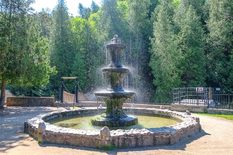
One of the most popular parks to check out is Belfountain Conservation Area. It’s popular for day-trippers because there’s a lovely bridge that overlooks a dam/waterfall. We went for a hike there and it was beautiful. There is even a picnic pace for families. If you head for Belfountain, be sure to stop for a coffee and treat at Higher Ground Café!
Another feature of the Caledon area is the Forks of the Credit Provincial Park. This top outdoor area is actually connected by trails to Belfountain and a very popular draw to the Caledon Area – mainly because it’s on the famous Bruce Trail.
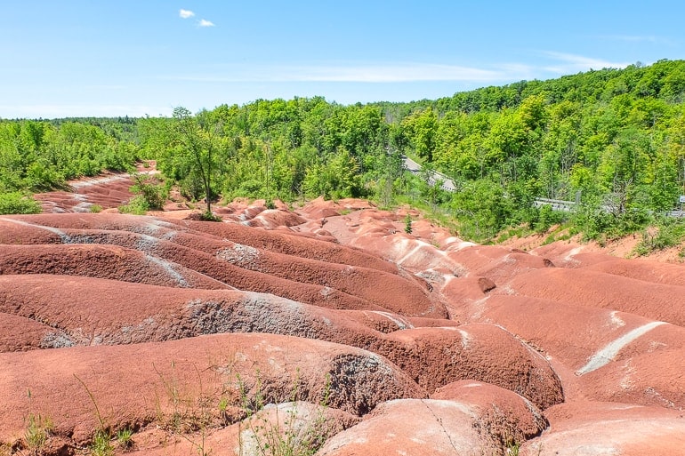
The last feature of the area that you can check out are the Cheltenham Badlands. As the name suggests, this rock formation resembles the red, rocky Badlands of Utah or Alberta. The eroding earth is very cool to see up close (but you can’t walk on it, which is good because that protects it from human activity).
They actually redid the visitor area so that you can now read all about the history, hit the hiking trails, and have a place to park that’s paid and off the main road. Our advice is to go early since the lot is small!
Address for Cheltenham Badlands: 1739 Olde Base Line Road, Caledon, ON L7C 0K6
Toronto to Caledon By Car
Spoiler: This Caledon “explorer’s day trip” is best/only done with a car. Caledon isn’t too far from Toronto – but where you are starting off will greatly dictate your route. Generally speaking, Caledon is to the northwest of Toronto past Brampton.
Once you get out of Toronto in the west end, you can take any of Highway 10, Dixie Road, or Airport Road northwest into the area. The driving distance is about 60 km and will take 45 minutes or longer (like an hour) with traffic.
Toronto to Caledon By Bus
Honestly, it would be hard to maximize your time in the area if you travelled by bus to Caledon. That said, you could get to Brampton GO Station via bus or train from Union and then take the bus 37 towards Orangeville and get off in Caledon Village. You’d have a hard time from there, though. Maybe pay for a taxi to take you around?
Collingwood + Blue Mountain
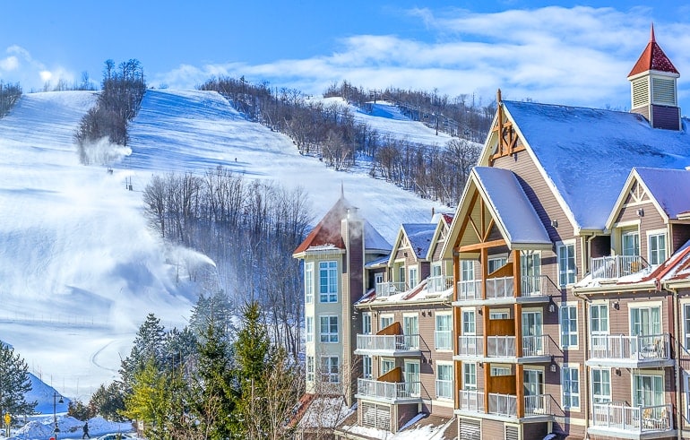
Summer or winter, it doesn’t matter – it’s always a good idea to head up to Collingwood and the Blue Mountains on a day trip! The town of Collingwood – located on the shores of southern Georgian Bay – is small with a nice walkable downtown area full of shops and places to eat.
You have to drive through Collingwood to get to the actual “Blue Mountains” which are a raised geological area. There, you’ll find Blue Mountain Resort – arguably the best summer/winter resort in the province.
From top slopes in the winter to dozens of activities in the summer, it’s a popular spot to check out. Eric hasn’t been in a few years but we’re going this winter because he wants to show Lisa!
Another place you can check out if you’re heading that way is the Scandinave Spa at Blue Mountain. This VERY popular spa experience is the perfect way to unwind (especially in the winter) with outdoor baths, waterfalls, massages, fire pits, and more.
Address for Blue Mountain Resort: 190 Gord Canning Dr, The Blue Mountains, ON L9Y 1C2, Canada
Toronto to Collingwood By Car
By far the easiest way to get to Collingwood is by car. Collingwood is located to the north of Toronto on the south shore of Georgian Bay (getting into Ontario cottage country) about 2 hours and 20 minutes driving (about 160 km driving distance).
The best route is very similar to how you drive to Caledon – through Brampton, Orangeville (Highway 10) and then just follow County Road 124 basically the rest of the way.
The other route is up Highway 400 (the way to Barrie) but then you have to head west quite a bit and make a bunch of turns. This route also takes longer because traffic is usually awful on the 400.
Once you arrive in Collingwood, there’s plenty of street parking. If you are heading for Blue Mountain, you will find that they have a large parking lot, too.
Toronto to Collingwood By Bus/Shuttle
You can actually get to Collingwood by bus BUT it only leaves once a day in the afternoon and takes over 3 hours. Regardless, you can find bus tickets with Greyhound.
Another option (for just the winter season) is private tour/shuttle services that run from Toronto to Collingwood. Check out AU Coach Tours with downtown Toronto pick-ups to Blue Mountain.
Related: The Best Time to Visit Canada – Seasons and Activities
Wasaga Beach
Speaking of southern Georgian Bay, how about a day at the beach? How about a day at the longest freshwater beach in the world?! Well, that’s Wasaga Beach for you.
Located in the town of Wasaga Beach north of the city (just east of Collingwood), the stretch of shoreline offers visitors 14 kilometres of sandy beach and summer and winter fun.
Officially Wasaga Beach Provincial Park, the beach is Blue Flag certified (that means it’s really good/safe for world standards) and also includes walking and cross-country ski trails in the winter!
Along the waterfront (in the summer), there are a TON (seriously, very many) restaurants, bars, stores, and shops – you name it, it’s there! The area also has a bit of natural and war history to check out at Nancy Island Historic Site.
Address for Nancy Island: 119 Mosley St, Wasaga Beach, ON L9Z 2X1, Canada
Toronto to Wasaga Beach By Car
Once again, for the purposes of a day trip, the best/only option to get to Wasaga Beach is by car. The town and beach are located about a 2-hour drive north of Toronto with a driving distance of about 150 kilometres.
The route is basically the same way you would head to Collingwood but instead head slightly east instead of west when you reach Georgian Bay. You can also go up Highway 400, get off in Barrie, and snake along smaller highways and county roads to get there.
Once you get there, you’ll find ample parking. Some lots and spots are 5 dollars close to the beach. You can also park inside the official park – but it’s 3 or 4 times that price!
Prince Edward County
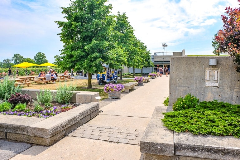
This is probably one of the farthest day trips we have on the list, but a day trip to Prince Edward County is definitely worth it! This “island-like” region (it’s technically a peninsula) extends into Lake Ontario. It’s a great region with unique geography from sandy dunes to fertile land for wine grapes!
As such, PEC – also often called “The County” – is known as another of Ontario’s wine regions! Personally, we really like PEC and we’ve spent quite a bit of time exploring the whole region.
That said, there is lots to do in The County. The main towns – Picton and Wellington – offer you shops, cafes (like Beacon Bike and Brew), restaurants, and more. You can head for the beach or hike the massive dunes when exploring Sandbanks Provincial Park.
However, the region is best known for its wineries. There are close to 40 wineries – bigger operations and smaller family-run ones. Check out Huff Estates or Sandbanks Estate Winery – famous for their Baco Noir.
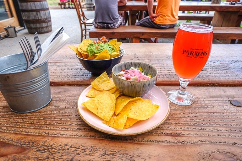
There are also lots of breweries like Parson’s Brewing Company and Lake on the Mountain Brewing Co. (another of our favourites). You also can’t forget about The County Cider Company! We really can’t do the area justice – you have to go and see for yourself! Just remember if you have alcoholic beverages, you shouldn’t be driving (and have a designated driver).
Address for Beacon Bike and Brew: 188 Picton Main St, Picton, ON K0K 2T0, Canada
Toronto to Prince Edward County By Car
The best (and only) way to get to and get around the County is by car. There’s just no way around it. The drive from Toronto is pretty easy – just take Highway 401 east, get off in Belleville (or exit #522), and head south into the County.
To head right to Picton, the drive will be about 2 hours and 30 minutes (210 km driving distance) but once you’re there you have the whole region to explore! Parking will vary but all wineries and breweries have parking plus there’s ample street parking in Picton, Wellington, etc.
Alternatively, if you have a group of people you could look into renting a limo or hiring a taxi for a whole day. If you split the cost, it would make for a more manageable trip – plus then you have a designated driver secured all day!
Toronto to Prince Edward County By Train
You can’t really travel to Prince Edward County by train. The best you could do is to get to Belleville on the ViaRail. Then you’d have to rent a car or get a taxi to get into the County – even then you’d need a direction like Picton or a specific winery.
Toronto to Prince Edward County By Bus
Again, no great options here. You can take the Greyhound to Belleville but then you still need to rent a car or grab a taxi.
Barrie + Oro-Medonte
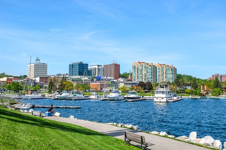
If you want to spend a day at the beach/another lovely little waterfront, then you should head for Barrie! Barrie is actually a relatively large city located north of Toronto up on the shores of Lake Simcoe at Kempenfelt Bay.
As a day trip, you wouldn’t need to visit most of the city (it sprawls out quite a bit). You would be perfectly fine heading for the small downtown area by the waterfront (Dunlop Street East). Here, you’ll find a few shops, restaurants, pubs (Donaleigh’s Irish Public House), and even a great brewery – Flying Monkeys – with a nice patio.
At the waterfront, there are numerous parks with walking trails along it that run for kilometres. Heritage Park is close to downtown and if you walk south, you can find the main one – Centennial Park and Centennial Beach.
If you want to get out on the water, you can rent a canoe, kayak, or paddleboard from the small stands along the shoreline. You can even check out the Spirit Catcher sculpture – and there are stalls for ice cream, too!
Address for Flying Monkeys Brewery: 107 Dunlop St E, Barrie, ON L4M 1A6, Canada
If you are heading up to Barrie, you might also be interested in heading a bit further north. Just a bit farther up the highway, you’ll find the township of Oro-Medonte and more for a variety of the areas ski hills/recreation areas!
Specifically, check out Hardwood Hills Ski and Bike – mountain biking, hiking, and disc golf in summer and cross country skiing in winter. You might also try Snow Valley Resort, Horseshoe Resort, or Mount St. Louis Moonstone for winter skiing/tubing and some summer activities (Horseshoe is open in summer).
Toronto to Barrie By Car
Barrie is located basically due north of Toronto. As such, the easiest way to get from Toronto to Barrie is by car. The driving distance is about 100 km and it’ll take about one hour 30 minutes (depending on traffic) on Highway 400 (the major highway you take all the way there).
As you get close to Barrie, get off at Bayfield Street to head for downtown and the waterfront. There is lots of paid parking once you get downtown or to the waterfront.
If you want to head for any of the ski hills north of the city mentioned above, you need a car. Many are accessible past Barrie on Highway 400 or on Highway 11 northbound.
Toronto to Barrie By Train
Depending on the time of day, you could take the GO Train to Barrie but they usually only run at night in this direction (to bring commuters home).
So, to go to Barrie in the morning, you’ll need to take the GO Bus OR a combo of train and bus (see more below). The overall trip would take about one hour and 30 minutes. Here’s the GO Route Planner.
If you do take the train, you will head for Allandale Waterfront GO Station which is right by the waterfront and a short walk to downtown. Just so you know: Barrie city transit is included in your GO fare if you got off the train and travel within 30 minutes of getting into Barrie. You can learn more here.
Address for Allandale GO Station: 24 Essa Road, Barrie, Ontario
Toronto to Barrie By Bus
There are more options for taking the bus to Barrie. As we mentioned above, you can take the GO Bus, Ontario Northland, or Greyhound.
To be honest, the Greyhound and the Northland are direct trips whereas you may have to change via the GO Bus so you pick your battle here. You can check for fares and times on the Greyhound and Ontario Northland.
These two buses leave from the same place in Toronto (Toronto Bus Terminal at 610 Bay Street). The GO Bus leaves from Union Station Bus Terminal (down on Front street). Whichever you take, all buses end at the same station near the Barrie Waterfront downtown.
Address Barrie Bus Terminal: 24 Maple Avenue Barrie ON L4N 7W4
Gravenhurst + The Muskokas
If you want your chance at getting a taste of the famous “cottage country” region in Ontario known as the Muskokas, then head to Gravenhurst! This small town just off Highway 11 has plenty of natural beauty to check out for a day.
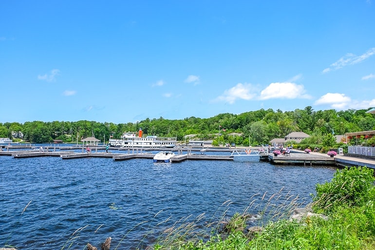
Nestled up in the bottom of Lake Muskoka, Gravenhurst has a nice little downtown, some historic sites, and a great Wharf area with boardwalk to check out. Of course, you can go MUCH higher up into Ontario – but these wouldn’t be day trips (that’s for another article)!
Once in Gravenhurst, you might want to visit Gull Lake Rotary Park or Lookout Park overlooking the water. Another classic thing to do is to take a cruise on the vintage Muskoka steamships and check out the Discovery Centre to learn about the area. Just be sure to book in advance if you want to cruise because they can sell out in the summer WELL in advance!
Oh, and if you’re passing through downtown Gravenhurst don’t forget to check out Sawdust City Brewing. This brewery does amazing craft beer and has a great venue for tastings and events. They just finished a new outdoor patio at the time of writing this and are always friendly when we visit.
Address for Sawdust City Brewing: 397 Muskoka Rd N, Gravenhurst, ON P1P 1G3, Canada
Toronto to Gravenhurst By Car
Unsurprisingly, the best way to get to Gravenhurst and explore it is by car. Gravenhurst is located north of Toronto (past Barrie) up Highway 11. It’s about a 2 hours driving (170 kilometres driving distance) so if you leave in the morning you can get in a whole day of hiking, eating, and enjoying!
Once you get to Gravenhurst, there’s free parking down at the waterfront Wharf area and street parking along the main street through “downtown”. We had no problem finding parking!
Toronto to Gravenhurst By Bus
The Ontario Northland bus does go from Toronto to Gravenhurst around 3 times a day – but the trip takes 2 hours and 50 minutes.
We’d say it’s a great idea but for the purposes of a day trip you might want that extra hour back so perhaps driving is best. That said, you can see the prices and schedule for Ontario Northland here.
Guelph
If you are feeling the green vibes and want another option for the country, then you should head to Guelph! This growing farm town is very agriculturally-conscious, and there’s actually lots to see and do!
We like Guelph quite a bit. It’s got a nice downtown core with restaurants, bars, and plenty of shops. As for things to do and see, there’s a famous Farmer’s Market on Saturday, a massive Basilica on the hill, a civic museum, The Bookshelf, and more. You can even skate at City Hall in winter!
If you want to connect with nature, you can rent a canoe/kayak on the rivers (and eat an ice cream at “The Boathouse Tearoom“), walk the numerous walking trails through the parks, check out the Arboretum, or head north of the city to Guelph Lake Conservation Area with a beach!
Oh, and Guelph is known for its breweries – so be sure to visit Brothers Brewing right downtown or Royal City Brewing for a taste of some great craft beer!
Address for The Bookshelf: 41 Quebec St, Guelph, ON N1H 2T1, Canada
Toronto to Guelph By Car
As with most places on this list, it’s easiest/best to get to Guelph by car for the purpose of a day trip. Guelph is located west (and a bit south) of Toronto. Just take Highway 401 for about 1 hour 20 minutes (traffic depending).
It’s about 90 kilometres driving distance so not too far – and it’s an easy one. You then take Highway 46 (which is exit #299). This turns into Gordon Street and you’ll drive right downtown Guelph.
Once downtown, there are lots of places to park whether you’re looking for street parking or parking lots. Parking in the Baker Street lot means you can go eat at Baker Street Station Pub which is a quick walk from downtown.
Toronto to Guelph By Train
You actually can get to Guelph by train with the ViaRail but you’d have to time it right. It goes from Toronto to Guelph once in the morning and returns once at night quite late. It’s just over an hour to ride so you can check the ViaRail schedule here.
You can’t take the GO Train the whole way to Guelph in the morning because it doesn’t go the whole way. You’d have to start off with train and change to the GO Bus (usually in Mount Pleasant) along the way.
Once again, this is because you’re going “against” the commuters to/from Toronto in the morning and evening so the schedule doesn’t work in your favour.
Toronto to Guelph By Bus
As for the bus, you COULD take the GO Bus the whole way if you left early in the morning or take the GO train/bus combo later in the morning (you can see the schedule here) or you could take the Greyhound.
If you take the Greyhound, this option is way easier because you just get on downtown and get to Guelph with no changes. It takes anywhere from 1 hour 30 minutes to 2 hours which is very reasonable. Check the Greyhound schedule here.
Grand River + Cambridge
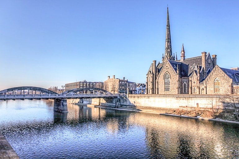
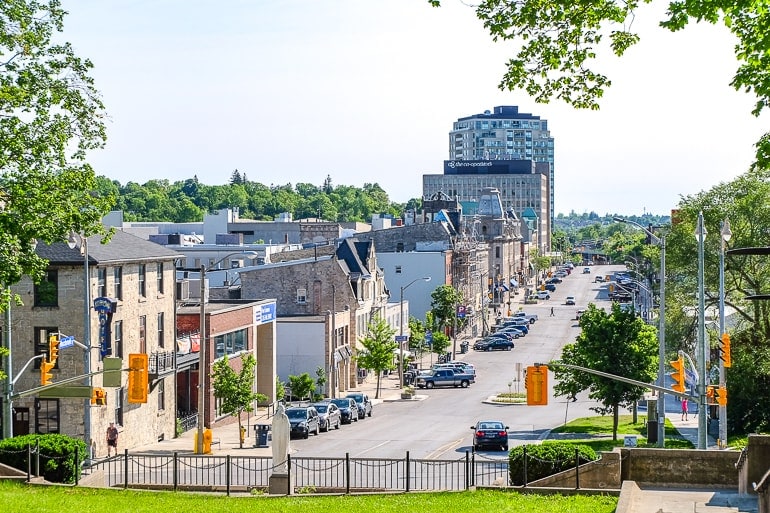
If you want more of a hidden gem day trip from Toronto, you might consider heading to Cambridge, Ontario! Once known as Galt, this smaller city close to Kitchener is located right on the Grand River – an important feature in Ontario’s landscape and history.
The city is small with a few things to do downtown such as checking out McDougall Cottage Historic Site. There are also pathways along parts of the river that cut through green spaces.
Outside the city centre (this is where a car comes in), there are things like the Cambridge Butterfly Conservatory, Shade’d Mills Conservation area, and Chicopee Resort for winter tubing and summer fun, too! Eric has played disc golf at Chicopee in the summer and it was an absolute blast!
One of the top activities along the Grand River is river tubing in the summer. There are a few places you can do it but Cambridge is certainly a popular location. Tubing the Grand launches north of the city centre up the river!
Address for Downtown Cambridge: 25 Queens Square, Cambridge, ON, Canada
Toronto to Cambridge By Car
No surprise, but it’s best to head to Cambridge with a car. The city is located to the west and a little south of Toronto (south of Guelph). Just take Highway 401 westbound out of the city.
You can then take exit #286 or #282 and head south into Cambridge. 282 takes you RIGHT into downtown along the river. Total driving distance is about 100 km and 1 hour (of course, traffic depending). Once you get there, there’s street parking and a handful of lots to park in.
Toronto to Cambridge By Bus
Since there is no train from Toronto to Cambridge, you have to take the bus. For this, you can take the Greyhound. The bus that makes sense for a day tripper is the 8:30 am bus that takes 1 hour and 30 minutes (no traffic).
You can find bus tickets on the Greyhound website. The stop isn’t right downtown once you get there, so you’ll have to hop on a local bus or walk.
Address Cambridge Stop: 44 Pinebush Rd (behind the Keg Restaurant)
Kawartha Lakes
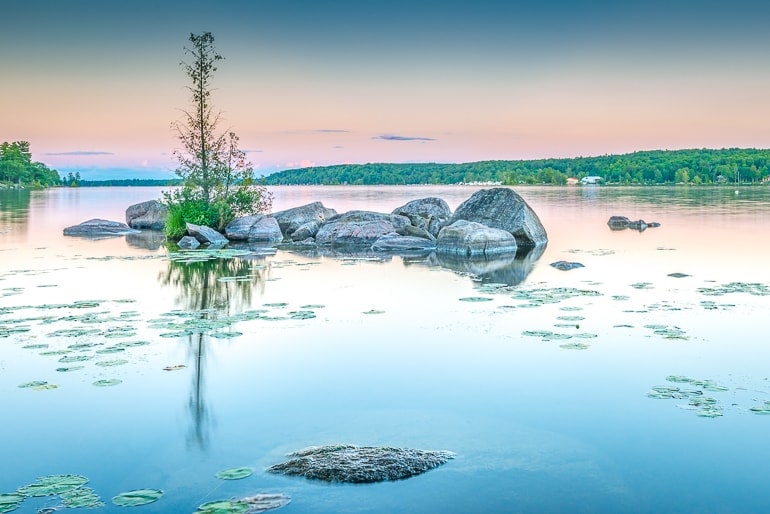
One more day trip to the other famous Ontario Cottage region doesn’t hurt, right? Then you may want to check out Kawartha Lakes! Kawartha Lakes is an actual place, the Kawartha Lakes are a grouping of lakes, and the “Kawarthas” is the name that has come to represent this area of unique rocky landscape and lakes!
The region is known to include towns like Bobcaygeon (also the name of a famous song by the Tragically Hip – a Canadian band), Lindsay, and Buckhorn, and features popular lakes like Stoney and Sturgeon. There are a few parks in the area – such as Kawartha Highlands Provincial Park and Petroglyphs Provincial Park but they are farther to the east.
Heading more south (close to Campbellford) you’ll find the Ranney Gorge Suspension Bridge on the Trent-Severn Waterway. This is a great stop if you want another short walk and amazing photos!
Oh, and don’t forget to eat some Kawartha Dairy ice cream. You can find it all over Ontario but it bears the name of the famous region being founded in Bobcaygeon!
Address for Lindsay: Cambridge St N, Lindsay, ON K9V 4C6, Canada
Toronto to Kawartha Lakes By Car
Given the large nature of the area, this day trip is best done by car. Luckily, there are a few ways to get to the area – and it depends on where you are actually heading to in the region.
To drive to Bobcaygeon, for example, you’ll head to the northeast of Toronto about 2 hours (traffic depending) on Highway 401 to Highway 115 then to Highway 35.
The distance is about 160 kilometres so it’s not too long but it’ll certainly be a bit of a trek. You will want to start in the morning so as to not waste the day.
Milton Conservation Areas
If you want an area that is jam-packed with outdoor adventure in all seasons, you should head for Milton, Ontario! If you’re a local, you might be laughing, but hear us out. Milton is home to some top conservation areas with excellent trails for hiking, snowshoeing, and scenic views.
The reason Milton has such a great outdoor scene is because of the Niagara Escarpment. It runs along the edge of town (and includes part of the Bruce Trail) and shapes the landscape.
As such, there are three places in particular that – if you head out to Milton – you should check out: Rattlesnake Point Conservation Area, Kelso Conservation Area, and Crawford Lake Conservation Area.
In the summer season, these places can get pretty busy (because of the stunning views/vantage points from the high cliffs). So if you plan on being a day-tripper from Toronto, be sure to be safe when you visit and be flexible enough to check out another area. If you go in the winter, bring your skis and/or snowshoes to make the most of the trails!
Address for Rattlesnake Point CA: 7200 Appleby Line, Milton, ON L9E 0M9, Canada
Toronto to Milton By Car
Exploring the Milton/Halton area is easiest by car – especially if you plan on visiting more than one place while out for the day. The drive to Milton is pretty easy – you just take Highway 401 west out of Toronto and head for exit #320. In fact, all three areas above can be found from this exit.
The drive will take about an hour (for about 70 km driving distance) but since you are going against commuter traffic in the morning and afternoon you might be spared super stuffy traffic in/out of the west end. Good luck!
Toronto to Milton By Train/Bus
Milton has a GO Station in the town centre that is serviced by GO Bus and Train – the issue is much like the day trip to Barrie: if you wanted to go to Milton in the morning, the train would be coming against you to bring commuters to work. That said, you can still have a look at the GO website.
Cobourg Beach + Cobourg
If you haven’t had enough of beaches – and you don’t want to drive to get to one – then you have one more potential option: heading to Cobourg, Ontario! This small town on Lake Ontario boasts one of the best beaches in the province – and it’s right downtown close to the centre!
Cobourg Beach is a public beach with lots of amenities and green space, food options nearby, a splash pad for kids, and there are even camping grounds. A highlight is that there are walking trails along the water that extend along the shoreline – so there’s more to do than just visiting the beach.
As for Cobourg itself, the downtown core is small but full of little shops, cafes, places to eat, bars, an art gallery, and more! Oh, and don’t forget to photograph the lighthouse if you go. It’s quite nice down by the Harbour!
Address for Cobourg Beach: 138 Division St, Cobourg, ON K9A 3P3, Canada
Toronto to Cobourg By Car
The best option (as per usual) is to drive to Cobourg. From Toronto, you head east on Highway 401 for about 1 hour and 30 minutes (120 km driving distance). Take exit #472 and head south to the water. Once you get there, you can find parking on the street or in a paid lot.
Toronto to Cobourg By Train
You actually could take the ViaRail train to the beach (there is no GO service). Cobourg has a ViaRail station not too far from downtown. The trip will take an hour each way.
The good news is you could do it – leave in the morning and return to Union at night. The potential bad news is for the price you could rent a car and pay for a tank of gas for cheaper (season depending). In any case, it’s an option! You can check for times and prices at the ViaRail website.
Buffalo, USA
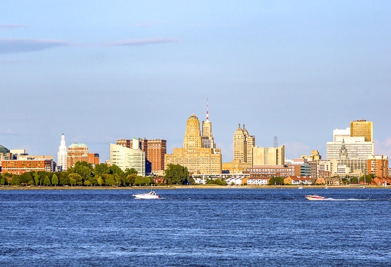
If you’re looking for day trips to the USA from Toronto, Buffalo, New York is probably your best bet! Buffalo is surprisingly not far from Toronto – making it a popular spot for cross-border shopping.
Once you get downtown, you can check out the Canalside area, the Naval and Military Park, the Theodore Roosevelt Inaugural National Historic Site, and more! Mind you, this is an international border so you will definitely need to bring ID with you to go there and back!
Address for City Hall: 65 Niagara Square, Buffalo, NY 14202, United States
Toronto to Buffalo By Car
Being located across the border and south of Niagara Falls, driving to Buffalo is a good option – but you should definitely get a head start in the morning. From Toronto, you take our friend the QEW/Highway 403 towards Hamilton and then head for Niagara Falls.
You can then choose: cross into the USA at Niagara Falls and the Rainbow Bridge OR drive south to Fort Erie and cross on the Peace Bridge (closer to actual Buffalo)!
The trip will take anywhere from 2 to 3 hours (about 170 km driving distance). Thing is, you pass through so many areas that MAY slow you down that it’s just hard to really nail down an exact time.
Toronto to Buffalo By Bus
Luckily, because it’s a popular city, you can take both the Greyhound OR Megabus to Buffalo. Both leave from 610 Bay Street in Toronto and both vary by time: Greyhound can do it in about 3 hours one way while Megabus takes around 2 hours. It depends on the day of travel.
You can check here for schedules and prices with Greyhound or here for the Megabus website. Both buses arrive into the same station.
Address Buffalo Downtown Terminal: 181 Ellicott St, Buffalo, NY 14203, United States
And there you have it – a rundown of some of the best day trips from Toronto. Of course, there are a handful more places to check out and dozens of single attractions, but we think we’ve rounded up the best trips to keep you busy for a full day! Let us know where you end up – we’d love to hear it!
As always, Happy Toronto Day Trip Waddlin’,
-L&E
Pin it for later!